What's New
This page contains highlights of each deck.gl release. Also check our vis.gl blog for news about new releases and features in deck.gl.
deck.gl v9.3
Release date: April 13, 2026
Widgets
 PopupWidget |  SplitterWidget |  ScrollbarWidget |
Many experimental widgets got a design overhaul in v9.3, along with new additions to the catalog.
- The InfoWidget, ContextMenuWidget and the new PopupWidget now use popper under the hood to provide smarter UI placement that responds to window size, content size and scroll position.
- New generic-purpose controls rendered by IconWidget, ToggleWidget and SelectorWidget cover many common use cases that would otherwise require implementing your own custom widget.
- SplitterWidget now supports arbitrary division of the canvas, as well as a cleaner API that no longer requires any custom viewport calculation.
- New ScrollbarWidget lets users get around a large orthographic canvas just like scrolling an HTML page.
- TimelineWidget has a fresh new look that is entirely customizable via CSS variables.
FpsWidgetis merged into StatsWidget as a unified, sleek-looking debugging surface.
Widgets now support controlled and uncontrolled component patterns, enabling app developers to control, observe, and intercept user interactions. Widgets with internal state — such as TimelineWidget, StatsWidget, and ThemeWidget — accept controlled props (e.g. time, playing, expanded, themeMode) alongside initial* props for uncontrolled defaults. All widgets now fire state change callbacks (onTimeChange, onPlayingChange, onExpandedChange, onThemeModeChange, onFullscreenChange, onLoadingChange, onReset, onZoom, onGeocode, onChange) for common integration patterns.
Aside from the above, all widgets also received the following improvements:
- You can pass a
_containerprop to a widget to render it into any parent container. - All widgets now have React wrappers, exported from
@deck.gl/react. - All widget documentation pages now have live demos and easy-to-follow code samples.
- A bug was fixed where widgets used with the
DeckGLReact component did not block pointer interaction with the canvas underneath.
Views and Controllers
deck.gl v9.3 is a substantial step forward in 3D navigation and rendering support. See the new Using with 3D Tiles guide for a complete walkthrough.
New pickable: '3d' option on all layers enables depth picking, returning actual 3D coordinates on picked geometry.
View layout props (x, y, width, height, and padding) now accept CSS-style expressions such as calc(50% - 10px) so you can mix relative percentages with fixed pixel offsets when arranging multi-view layouts.
Class-specific improvements:
- New TerrainController - A terrain-aware controller that automatically adjusts camera elevation to follow 3D tilesets and elevated terrain.
- MapController - New
rotationPivot: '3d'option rotates around the object under the pointer, for more natural interaction with terrain and 3D tiles. - OrbitController now uses 3D picking to determine zoom and pan anchors, providing more intuitive navigation around 3D content.
- All controllers - New
maxBoundsoption constrains the camera within a (2D or 3D) bounding box, preventing users from navigating outside of the content area. - GlobeController - Major bug fixes and improved stability.
- OrthographicView is moving away from 2d-array zoom and adds per-axis
zoom*,minZoom*,maxZoom*props.
Layers

- TextLayer now supports per-object clipping box; and making text "sticky" when its container is partially off-screen. See a demo with this new example.
- TileLayer adds new
visibleMinZoomandvisibleMaxZoomprops to control the zoom range at which tiles are drawn, independent of the zoom range at which data is loaded. - Improvements to Tile3DLayer including better performance and tile tracking.
- WebGPU now materializes constant layer attributes into full buffers through
AttributeManager, improving compatibility for layers that rely on constant accessors.
Extensions
- PathStyleExtension now supports dashed strokes on ScatterplotLayer and TextLayer backgrounds, in addition to PathLayer. See #9864.
@deck.gl/mapbox
- In interleaved mode,
MapboxOverlaynow always renders layers in groups bybeforeIdorslot. This enables cross-layer extension handling (e.g. MaskExtension, CollisionFilterExtension) by default, without needing the previously experimental_renderLayersInGroupsprop. - Multi-view setups now work consistently across overlaid and interleaved modes.
- Basemap now works correctly when canvas has zero dimensions.
- Heatmap layer now blends correctly in interleaved mode.
@deck.gl/google-maps
- Overlaid layers now render at the correct DOM position when
interleaved: false.
deck.gl v9.2
Release date: October 7, 2025
New widgets | WebGPU layers | Interleaved postprocessing |
Widgets
- A suite of new widgets have been added to the
@deck.gl/widgetsmodule:- ContextMenuWidget
- FpsWidget
- GeocoderWidget
- GimbalWidget
- InfoWidget
- LoadingWidget
- ResetViewWidget
- ScaleWidget
- ScreenshotWidget
- SplitterWidget
- StatsWidget
- ThemeWidget
- TimelineWidget
- ViewSelectorWidget
- Pre-wrapped React components - deck.gl widgets are available via the
@deck.gl/reactpackage - Custom widgets in pydeck - via the
custom_librariesparameter, Python users can integrate custom deck.gl widgets seamlessly - Documentation for styling and custom themes - see Styling Widgets
WebGPU Early Preview
A few deck.gl layers can now be run on WebGPU in the website, by selecting the WebGPU tab:
See documentation about how to test WebGPU support.
Core
PostProcessEffectnow works correctly in interleaved modeView.clone()- New method that simplifies creating new Views with modified props, similar toLayer.clone()- Multi-view clear support - Enhanced support for controlling clear color, depth, and stencil buffers across multiple views, via
clear,clearColor,clearDepth,clearStencilprops
Layers
- New A5Layer - renders cells from the A5 geospatial indexing system. See new Global Grid Layers example
- IconLayer - new
sizeBasisprop - TextLayer - new
backgroundBorderRadiusprop
CARTO
- ClusterTileLayer and HeatmapTileLayer support H3 data
- VectorTileLayer supports labels for line & polygon data, via new
autoLabelsprop
Mapbox
MapboxOverlay- When usinginterleaved: trueand a Mapbox v3 Standard style, you may now control the ordering of layers by adding theslotprop to a layer.
deck.gl v9.1
Release date: Jan 21, 2025
Maplibre Globe View | React Widgets | Aggregation Layers |  WebGPU readiness |
Globe View ♥ MapLibre
deck.gl now works seamlessly with the MapLibre v5 globe view for all three Basemap Intergration Modes. The experimental GlobeView has been updated to match MapLibre's camera at the same zoom level. MapboxOverlay works with maplibre-gl globe map without additional configuration.
The Maplibre globe view integration was done in close collaboration with the MapLibre team.
React Widgets
deck.gl v9.0 added support for widgets, with v9.1 users can now create React components with the same level of deep deck.gl integration.
- All the official deck.gl widgets can now be easily wrapped into React components with the new
useWidgethook. - Pre-wrapped React components for existing widget are available from the
@deck.gl/reactpackage. - To try it out, check out our React getting started example for using widgets in React.
Widgets Developer Guide
deck.gl v9.1 provides the ability to for applications to write React component that integrate with deck.gl using the widget interface.
Aggregation layers upgrade
v9.1 restores the GPU aggregation functionality that was temporarily disabled in v9.0. It brings a major refactor of the aggregation layers, with full TypeScript and unit test coverage.
A new generic Aggregator interface makes it much easier to support custom aggregation operations. The current implementations of this interface include CPUAggregator and WebGLAggregator, with WebGPUAggregator on the roadmap.
Highlights:
GridLayernow utilized both CPU and GPU aggregators in the same code path.HexagonLayernow supports GPU aggregation. Enable withgpuAggregation: true.GridLayerandHexagonLayercan use*ScaleType,*UpperPercentile,*LowerPercentile,onSet*Domainprops along with GPU aggregation.GridLayerandHexagonLayernow support non-geospatial views.- New picking info types for each aggregation layer.
See upgrade guide for more details.
WebGPU readiness
- luma.gl has been updated to v9.1 which focuses on improved WebGPU support. For details see release notes and upgrade-guide.
- As part of WebGPU readiness, all shader code in deck.gl v9.1 (layers and extensions) have been migrated to use uniform buffers instead of WebGL1 style uniforms.
- For most users this change should be transparent, but custom layers that add
uniformsshould start migrating asap as WebGL1 style uniform support is being actively phased out.
deck.gl v9.0
Release date: March 21, 2024
WebGPU | Typescript | Widgets | Category filtering |
WebGPU enablement
deck.gl v9 adopts the luma.gl v9 API. This will enable deck.gl to run on WebGPU in future releases, however it does cause some unavoidable breaking changes.
WebGPU is the next generation API for accessing GPU capabilities on the web. Unlike the incremental transition from WebGL to WebGL2, the shift to WebGPU completely changes the way the browser will interact with the GPU. The new (v9) version of luma.gl has been rewritten to adopt a WebGPU-compatible interface, while maintaining full support for WebGL2. deck.gl v9 has been extensively refactored on top of the new luma.gl API, but the deck.gl API itself includes minimal changes. This should allow applications to smoothly update to the latest version.
While the v9 luma.gl release is feature-complete and well-tested for the WebGL2 adapter, work is still required to provide full WebGPU support. The team is planning to follow the v9 releases soon with v9.1, which will provide the WebGPU implementation in luma.gl along with the complimentary updates in deck.gl.
Development experience
Typescript types, which were provided as an opt-in in 8.9, has now been enabled by default in v9.
All the deck.gl packages are now published as fully ESM-compatible.
Improved FirstPersonController
The behavior of the FirstPersonController has been modified to more accurately reflect the motion of a human, making it more intuitive to navigate a 3D space. In addition, panning is supported.
Category filtering in DataFilterExtension
The DataFilterExtension has been enhanced to support filtering based on categories. A new accessor, getFilterCategory, is added which allows filtering using the new filterCategories.
@deck.gl/widgets (New module)
You can now add UI components to deck.gl. This new module lets apps add controls and information that can interact with deck.gl's cameras and layers for a better user experience. To get started, check out the example and the documentation.
This module initially contains the following widgets:
You can also create your own widget by implementing the Widget interface.
@deck.gl/carto
-
New CARTO module architecture: Sources and Layers replace the CartoLayer. Read more in the Upgrade Guide.
-
Public preview for Boundary Sources (experimental): easily aggregate large data volumes aggregated into common or custom geographic boundaries, such as postal codes. Learn more about Boundaries in the CARTO documentation.
Known Limitations
The following issues are known and will be resolved in a v9.0 patch release:
@deck.gl/aggregation-layers(ScreenGridLayer, ...) performance - aggregation layers temporarily use CPU fallbacks which are less performant.
deck.gl v8.9
Release date: March 9, 2023
 CollisionFilterExtension |  TerrainExtension |  WMSLayer |
Extensions
Two new extensions are added in the 8.9 release: CollisionFilterExtension and TerrainExtension.
The CollisionFilterExtension allows layers to hide features which overlap with other features. An example is a dense ScatterplotLayer with many points which overlap: by using this extension points that collide with others are hidden such that only one of the colliding points is shown. The collisions are computed on the GPU in realtime, allowing the collisions to be updated smoothly on every frame. Visit the documentation and example to get started.
The experimental TerrainExtension renders otherwise 2D data along a 3D surface. For example, a GeoJSON of city streets and building footprints can be overlaid on top of a elevation model. It is useful when viewing a mixture of 2D and 3D data sources. The re-positioning of geometries is performed on the GPU. Visit the documentation and example to get started.
In addition, MaskExtension now supports FirstPersonView, and supports a new maskInverted prop.
WMSLayer
The new experimental WMSLayer simplifies connection to WMS and similar map image services. In contrast to the TileLayer which loads many small image tiles, the WMSLayer loads a single image that covers the entire viewport in one single request, and updates the image by performing additional requests when the viewport changes.
Other Enhancements
- MapLibre GL basemap is now supported out-of-the-box by the scripting interface.
BitmapLayernow mixes translucent pixels correctly (Note: breaking change)TextLayerhandles text outlines better in sdf mode. Outlines are no longer clipped and responds tooutlineWidthas expected.TextLayer'smaxWidthis changed to use a more intuitive unit. See upgrade guide for details.IconLayerwhen used with auto packing preserves the aspect ratio of icons.SolidPolygonLayerandGeoJsonLayeradd a_full3dprop that tesselate 3D polygons better.@deck.gl/mapboxnow synchronizes camera better when the base map contains terrain.- TypeScript: data prop now correctly typed for each layer class
Code base upgrades
In preparation for the 8.9 release, we made major upgrades to the tools that support the development and publishing of deck.gl. This allows us to iterate faster and makes it easier for first-time users to get started.
- All examples are bootstrapped with vite
- Pre-bundled scripts built with esbuild
- Website rewritten using Docusaurus
- Tests are run with
tsnodewith ESM modules for node, andvitefor the browser
pydeck 0.8
- Compatibility with JupyterLab 3 and Google Colab
- Support
types.Functionin JSON Converter,configurationanddefault_layer_attributesin settings - pydeck-carto: support
CartoLayer, styling functions (color_bins,color_categories,color continuous), and authentication using carto-auth
deck.gl v8.8
Release date: June, 2022
TypeScript
Official typings are now available in deck.gl for public preview. It was a tremendous effort converting the deck.gl code base into TypeScript. We did it not just for TypeScript users to easily consume this library, but also for the overall robustness and maintainability of our own code base.
In v8.x, the types will not be exposed by default to prevent any typing errors from breaking existing TypeScript applications. You can opt in to using the typed version by switching your import statements to the @deck.gl/*/typed endpoints. Visit getting started with TypeScript to find out more.
Custom Indexing System in TileLayer
The TileLayer is fundamental when it comes to visualizing datasets so big that they cannot fit in the browser's memory. The idea is to only fetch and render content that is visible in the current viewport, and at the appropriate detail level. Up till now, the TileLayer has exclusively implemented the OSM tile index. If you wish to use it with your dataset, you had to use an offline tool or an backend that partitioned geospatial data into OSM tiles.
Starting from v8.8, the TileLayer supports custom indexing systems. Applications can now supply a custom implementation of Tileset2D to the TilesetClass prop. This makes it possible to use incremental loading with other indexing systems such as H3 and S2. The immediate use case is to allow the client visualization to work with any geospatial partitioning algorithm available in a database solution.
Due to this generalization, there is a breaking change affecting indexing properties (x, y and z) in the TileLayer API. See upgrade guide for details.
MapboxOverlay
The @deck.gl/mapbox module now exports a new class MapboxOverlay. The class implements Mapbox GL JS's IControl API. When adding a MapboxOverlay control to an mapbox map, deck.gl layers are rendered in synchronization with the base map layers. This control supports both overlaid and interleaved rendering modes. See the new get started example.
If you are using react-map-gl v7, this is the only solution to use deck.gl with React map control components (Navigationcontrol, GeolocateControl, etc.). See example.
@deck.gl/carto
CartoLayer includes native support to work with spatial indexes like H3 or QuadBin. More info here.
Enhancements
- Views now accept a padding option to offset the focal point.
- Improved performance when there are many invisible layers
- Improved picking performance when using the
TileLayer
deck.gl v8.7
Release date: February 25, 2022
MaskExtension
The new MaskExtension allows layers to show/hide objects by a geofence. For example, a map may filter a list of user locations by the boundaries of a given country, or highlight part of a base map that is inside a user-drawn circle or lasso area.
QuadkeyLayer
The new QuadkeyLayer renders filled and/or stroked polygons, with geometry automatically calculated based on a quadkey (geospatial index).
Enhancements
TileLayerreducedrefinementStrategy: 'no-overlap'.TileLayerrefinementStrategynow accepts a callback function enabling customer refinement strategies.TerrainLayercan now be used with non-geospatial views.ColumnLayeraddsflatShadingprop.GlobeViewlighting in 3D layers is more consistent.GoogleMapsOverlaysupports camera tilt and bearing for raster maps.MVTLayernow supportspointType: 'text'inbinarymode.- Picking with
project3D: truenow returns more accurate result in non-geospatial views.
@deck.gl/carto
- fetchMap - fetchMap is added to the CARTO deck.gl submodule, streamlining the display of maps created using CARTO platform.
- Support for large tables and Databricks. See CARTO documentation for more details.
deck.gl v8.6
Release date: October 11, 2021
Interleaving deck.gl layers with Google Maps vector rendering
The GoogleMapsOverlay class supports Google Maps' new vector map, providing the following advantages:
- Shared 3D space: objects drawn by the
GoogleMapsOverlayclass appear inside the Google Maps scene, correctly intersecting with 3D buildings and behind the contextual labels drawn by Google Maps. - Tilting and rotating the view is supported.
- Rendering uses the same WebGL context as Google Maps, improving performance.
See blog posts from Google Cloud and our own for the potentials of this feature.
Visit the new Google Maps integration example to get started.
OrthographicView
It is now possible to independently control the zoom of the X and Y axes.
- The
zoomprop of theOrthographicViewnow also supports an[x, y]Array to specify independent zoom levels. - A
zoomAxisoption is added to theOrthographicControllerto restrict zooming to the X or Y axes.
MapView
 Meter sizes in 8.5 |  Meter sizes in 8.6 |
- Meter sizes are now correctly calculated based on the latitude of the point being drawn, whereas they previously were based on the center point of the viewport. This brings the view into full compliance with the Web Mercator projection.
- A new unit enum
commonis added for scaling geometries without the distortion of the projection method. See updated documentation about the unit system. - A new
projectionMatrixoption allows overriding of the matrix that would otherwise be created from the other view states.
Layer Enhancements
CartoLayeradds newgeoColumnandcolumnsprops, enables more granular data fetching from CARTO backend.ColumnLayerandGridCellLayeraddradiusUnitsprop.H3HexagonLayernow supports manually forcing low-precision, high-performance rendering withhighPrecision: false.HeatmapLayeraddsweightsTextureSizeanddebounceTimeoutprops for fine-tuning performance.MVTLayernow defaults to handling geometries in binary.ScatterplotandGeoJsonLayeradd option to turn off antialiasing to avoid artifacts in depth oclusion.TileLayerno longer purges its cache when data changes, resulting in a smoother "reload" experience
deck.gl v8.5
Release date: July 26, 2021
 TextLayer background, border, padding and outline |  GeoJsonLayer pointType |  Tile3DLayer+I3S picking individual objects |
Layer Improvements
MVTLayer
Mapbox Vector Tiles parsing throughput is now 2-3x faster, due to MVT tiles being parsed directly into binary attributes rather than GeoJSON, and additional work (including triangulation) being performed on worker threads. Speed comparison on some example data sets (MVT tiles parsed per second):
| Data set | binary: false | binary: true | Speed increase |
|---|---|---|---|
| Block Groups | 2.86/s | 5.57/s | 1.94x |
| Census Layer | 6.09/s | 11.9/s | 1.95x |
| Counties Layer | 72.5/s | 141/s | 1.94x |
| USA Zip Code Layer | 8.45/s | 20.3/s | 2.4x |
Benchmarks ran using scripts on a 2012 MacBook Pro, 2.3 GHz Intel Core i7, 8 GB, measuring parsing time of MVTLoader only (network time and rendering is not included)
GeoJsonLayer
GeoJSONLayer now supports rendering point features as icons and/or text labels in addition to circles. Use the new pointType prop:
new GeoJsonLayer({
  ...
  pointType: 'circle+text',
  getText: f => f.properties.name,
  getTextSize: 12
})
For a full list of new props, visit the updated documentation.
TextLayer
The layer now supports automatically detecting the characters used in the data. Set characterSet: 'auto' to enable this feature.
New props are added for more flexible styling of the texts:
backgroundbackgroundPaddingoutlineWidthoutlineColorgetBackgroundColorgetBorderWidthgetBorderColor
See documentation for details.
Tile3DLayer
Tile3DLayer can now be rendered in multiple views. Previously if you use multiple views it was required to create one Tile3DLayer for each view. Using a single layer is more efficient by sharing the tile cache.
The layer now takes full advantage of new features in I3S 1.7 tile sets, including:
- Picking individual objects inside a tile
- Page nodes (improved performance)
- Draco compressed meshes (improved performance)
- Compressed textures (improved performance)
- PBR materials
- Vertex colors
- UVRegions
Other layer improvements
ScatterplotLayeraddsbillboardmodeTripLayeraddsfadeTrailmodePathLayernow supports controllingjointRoundedandcapRoundedseparately. Dashed lines viaPathStyleExtensionalso respects the cap type.PolygonLayerandGeoJsonLayer:autoHighlightnow highlight both the outline and the fill of the hovered polygon, instead of either the outline or the fill.HeatmapLayernow correctly rendersaggregation: 'MEAN'with user-suppliedcolorDomain.
Default transpilation and bundle size
The NPM distribution has dropped IE 11 support in exchange for an almost 20% reduction in size.
| Entry point | 8.5 Bundle (gzipped) | 8.4 Bundle (gzipped) | Comments |
|---|---|---|---|
| module (dist/esm) | 398 KB (115 KB) | 485 KB (128 KB) | Transpiled, tree-shaking enabled |
| main (dist/es5) | 686 KB (178 KB) | 812 KB (197 KB) | Transpiled, no tree-shaking |
Measured as the footprint of @deck.gl/core, bundled and minified with Webpack 4
To support older or less common browsers, make sure that node_modules is included in your application's babel settings.
For backward compatibility, the pre-built bundle (dist.min.js) is not affected by this change.
@deck.gl/react
The DeckGL React component is rewritten using functional component and hooks.
@deck.gl/carto
- Integration with CARTO 3 platform. With deck.gl and the CARTO 3 platform you can access directly your datasets and tilesets hosted in your current data warehouse (BigQuery, Snowflake, Redshift, Postgres). You don't need to move your data to CARTO plaform.
- A new
CartoLayeris available to unifyCartoBQTilerLayerandCartoSQLLayer. There are migration guides for both: CartoSQLLayer and CartoBQTilerLayer. - New
getDatamethod in CARTO 3 to support other deck.gl layers.
deck.gl v8.4
Release date: Jan 31, 2021
Better Interaction
Improved experience on mobile devices
All controllers now support smooth easing at the end of dragging and pinching. This can be turned on via the new inertia option:
controller: {inertia: true}
In addition, a three-finger swipe gesture is added to support changing pitch on mobile. It is enabled via the touchRotate option.
More customizable controller behavior
- New
dragModeoption for flipping pan/rotate modes - The
keyboardoption now accepts an object for customizing movement speed - The
scrollZoomoption now accepts an object for customizing wheel zoom speed and easing
New Deck component API
eventRecognizerOptionsfor fine-tuning gesture recognitiononInteractionStateChangecallback- The
getCursornow receives anisHoveringargument that indicates whether the pointer is over a pickable object.
MVT Layer
TileJSON
The data prop now accepts a TileJSON URL. The onDataLoad callback is fired when the TileJSON loads.
Query rendered features
A new method getRenderedFeatures is added for querying all visible features in the current viewport.
Features in WGS84 coordinates
onHover, onClick, onTileLoad, onTileError and onViewportLoad callbacks can now access features in WGS84 coordinates.
Binary mode
A new prop binary is added to the MVTLayer. If set to true, it removes the need for serialization and deserialization of data transferred by the worker back to the main process, as well as attribute packing in the main thread. The following numbers show the performance improvements in loading and rendering a full viewport:
| N Vertex | Binary | Non-Binary | Change | |
|---|---|---|---|---|
| Usa Admin States | 12K | 963ms | 1109ms | -13.16% |
| Counties Layer | 175K | 1222ms | 1956ms | -37.52% |
| Census Tract | 988K | 2713ms | 6242ms | -56.53% |
| Block groups | 1.57M | 4261ms | 9202ms | -53.69% |
| Usa Zip Code Layer | 1.38M | 2938ms | 6564ms | -55.24% |
Benchmark run on 2017 Macbook Pro, 3,1 GHz Dual-Core Intel Core i5, 16 GB memory, Intel Iris Plus Graphics 650 1536 MB. Resolution 1140x900. Network transfer time is not included
Layer improvements
- All layers
- Add a new
loadersprop to support additional data formats. See the Data Loading Guide for examples. - Layers that use a texture (e.g.
BitmapLayer,IconLayer,SimpleMeshLayer) now offer consistent support for a variety of input formats. Newly supported are plain object descriptors (e.g.{data: <Uint8Array>, width, height}) andHTMLVideoElementthat continuously updates. A new proptextureParametersalso allows easy customization of texture settings.
- Add a new
- HeatmapLayer adds new prop
aggregationwhich can be eitherSUM(default) orMEAN. - BitmapLayer
- picking callbacks now provide information on which pixel was picked.
- Adds experimental
_imageCoordinateSystemprop, so that raster tiles may render correctly inGlobeView.
- GlobeView now works with
COORDINATE_SYSTEM.CARTESIANandSunLight. - TileLayer now supports
modelMatrix. - IconLayer adds
onIconErrorcallback. - OrthographicView adds
flipYoption. - ArcLayer and LineLayer now render the shortest path with
wrapLongitude: true.
Additionally, various layers received performance optimization, corrected lighting calculation, and API consistency improvements. See upgrade guide for a list breaking changes in this release.
Functions in declarative language
@@function prefix is included to interpret a string as a JavaScript function.
@deck.gl/carto
Adds helper functions to create data-driven map visualizations using CARTOColors
deck.gl v8.3
Release Date: Oct 12, 2020
New module: @deck.gl/carto
 |  |
Integration with the powerful geospatial analytics platform CARTO.
This new modules makes it easy to visualize regular Tables and vector tilesets in CARTO. It offers two new layers:
- CartoSQLLayer: a layer to visualize data hosted in your CARTO account and to apply custom SQL.
- CartoBQTilerLayer: a layer to visualize large datasets (millions or billions of rows) directly from Google BigQuery.
This effort enables applications to leverage CARTO's smart back-end capabilities, dynamic queries and much more. Visit the module's documentation to get started.
TileLayer
getTileDatanow receives an additional argumentsignalthat implements AbortSignal. Tile requests may now be aborted if there are too many queued or ongoing requests.- The
getTileDatafunction passed in to the current layer instance will be called rather than the first layer instance. This allows applications to progressively adjust loading behavior without having to reload all tiles. - New
onTileUnloadcallback - URL templates now support
{-y}for TMS indexing - Experimental support for
GlobeViewinTileLayerandMVTLayer - Improved memory usage in tile caching
General Performance
Layers with pickable disabled (the default) skip generating picking attributes. This can improve initial loading time and memory usage if a large layer does not have to be interactive.
If no layer is pickable, deck no longer creates the picking FrameBuffer to save memory.
Deck also added some experimental optimization options to allow more fine-grained control of memory usage on memory-restricted devices.
pydeck 0.5
pydeck 0.5 includes new event handlers — on_hover, on_click, on_view_state_change, and on_resize — which can be used to create rich interactive applications in Jupyter. This release works in sync with deck.gl 8.3.
 Event handling in pydeck |  highPrecisionDash in PathStyleExtension |
Other Improvements
SimpleMeshLayeradds_useMeshColorsprop to use vertex colors frommeshinstead ofgetColorDataFilterExtensionadds acountItemsoption. It enables the GPU to report the number of objects that pass the filter criteria via theonFilteredItemsChangecallback.PathStyleExtensionadds ahighPrecisionDashoption. It creates nicer dashes when used with small path segments, at the price of some CPU overhead.IconLayerfixed an issue of visual artifacts rendering anti-aliased borders
deck.gl v8.2
Release Date: June 28, 2020
 FillStyleExtension |  MVTLayer highlight - v8.1 |  MVTLayer highlight - v8.2 |
Tiled Layers
Many new features are added to TileLayer, MVTLayer and TerrainLayer to improve correctness, performance and ease of use.
MVTLayerprojects more accurately at high zoom levels.autoHighlightin theMVTLayernow works on features that are split across multiple tiles, identified by the newuniqueIdPropertyprop.- All geospatially tiled layers now handle high pitch angles better. Far away tiles from the camera are loaded at lower zoom levels, avoiding loading too many tiles.
- Tiled layers now use a request scheduler to prioritize loading the most recently visible tiles during viewport navigation. See the new
maxRequestsprop. TileLayermay continue to display tiles when underzoomed. See the newextentprop.- Fine-tune the tiles displayed by the
TileLayerwith the newzRangeprop when dealing with 3D content. This is used by theTerrainLayerwhen viewing high-altitude regions. TileLayer'stileSizeprop can be used to fine-tune the zoom level at which tiles are loaded.TileLayer'srenderSubLayersis now always called after the tile layer is loaded, i.e.props.datais never a Promise.TileLayercan now be used in multi-view applications, as long as eachTileLayerinstance is rendered into one view. See documentation for an example.
GlobeView
For geospatial data, a new projection mode -- globe projection is now available alongside Web Mercator projection. In this release, the feature is exposed via the experimental GlobeView class.
Currently there is no base map provider under this view. You may use the BitmapLayer or GeoJsonLayer to render a backdrop for your data.
Before getting started with this example, make sure you check out the docs for the limitations of the current implementation.
Antimeridian Handling
GreatCircleLayernow renders correctly across the 180th meridian.- The
PathLayer,PolygonLayerandGeoJsonLayernow support thewrapLongitudeprop.When enabled, the connection between any two neighboring vertices is drawn on the shorter side of the world, and split into two if it crosses the 180th meridian. Note that this introduces CPU overhead at runtime.
Pydeck
Pydeck 0.4.0 introduces support for JupyterLab 2.0, support for a Google Maps base map, a new UI element for providing text descriptions of a map, and many of the new features of deck.gl 8.2, like the ability to render data to either a globe or a Mercator projection. See the new website for documentation and examples.
Miscellaneous
- Multiple layers that share the same
dataURL now only download the data once. ScatterplotLayeraddedradiusUnitsprop- New
FillStyleExtensionfills polygons with repeated pattern from a sprite image. ArcLayeraddedgreatCircleprop.GreatCircleLayeris now a special case of theArcLayerand support rendering an elevated curve by supplyinggetHeight.@deck.gl/test-utilsadded newtestLayerAsyncAPI.- When using auto-highlight,
highlightColornow accepts a callback that returns a color based on which object is picked.
deck.gl v8.1
Release Date: Mar 17, 2020
Growing Tile Solutions
 Non-geospatial TileLayer |  MVTLayer |  TerrainLayer |
The @deck.gl/geo-layers module added many new features to address popular tiled data use cases.
TileLayer
Multiple bugs have been fixed in the TileLayer regarding data fetching and tree traversal.
The layer now supports non-geospatial views. Check out this example by @ilan-gold that renders a 576 Megapixel image of the moon.
New props are added to better control the layer's behavior:
maxCacheByteSize: for precise management of memory usagerefinementStrategy: to reduce flashing/overlapping during loadingtileSize(non-geospatial only)
MVTTileLayer
Based on the TileLayer, MVTTileLayer loads and renders tiles in the Mapbox Vector Tiles specification. This new layer make it easier to leverage the many great open source tools in use with deck.gl.
This effort is led by contributors from CARTO.
TerrainLayer
TerrainLayer loads color-encoded heightmap and reconstructs 3D mesh surfaces. Check out our example.
ESRI + deck.gl
 deck.gl + ArcGIS basemap |  Tile3DLayer + I3S |
In collaboration with GIS industry leader ESRI, we are releasing new experimental features that work with ArcGIS basemap and I3S tiles.
@deck.gl/arcgis
You can now use ArcGIS basemaps with deck.gl. This new module lets apps render deck.gl layers into the WebGL context of ArcGIS API for JavaScript. 3D scene view support is experimental in this initial release. To get started, check out the example and the documentation.
Tile3DLayer and I3S format
Tile3DLayer is adding preliminary support for the OGC Indexed 3d Scene (I3S) format. See documentation for details.
World Repeating in Web Mercator Maps

The MapView now supports repeating worlds at low zoom levels. For backward compatibility, this feature is opt-in. Apps may turn it on by setting views: new MapView({repeat: true}) on Deck or DeckGL.
Repeating is always on when using MapboxLayer and GoogleMapsOverlay.
As a result, GoogleMapsOverlay now supports all Google Maps zoom levels.
pydeck 0.3.0
pydeck now uses the binary attribute API to communicate between Python and JavaScript. This greatly increases the speed and the amount of data that it can render.
pydeck now supports external layer modules via a new custom_libraries setting.
Other Improvements
- When using
Deckas a stateful component, you can now update itsinitialViewStateprop to reset the camera. - A new prop
onErroris added toDeckto handle errors, instead of crashing the app. Layerinstances now expose a new memberisLoaded.PathLayer's joint calculation is improved when using with short line segments and extreme angles.BrushingExtensionsupports a newbrushingTargetmodesource_target.PathStyleExtensionnow has a new modeoffset. This feature can be used for positioning polygon strokes inside/outside, or rendering overlapped paths in opposite directions.TextLayernow supports binary attributes.
deck.gl v8.0
Release Date: Dec 20, 2019
Performance
Performance is one of the biggest focus of this update. Layer updates (data change) is 1.5x the speed of the last release, and redraw (viewport change) is 2.5x.
Benchmark of using 1000 ScatterplotLayers on 2016 Macbook Pro, 2.8 GHz Intel Core i7, 16 GB memory, AMD Radeon R9 M370X 2 GB
| v7.3 | v8.0 | Change | |
|---|---|---|---|
| Initialize | 298ms | 235ms | -21% |
| Update | 112ms | 72ms | -36% |
| Redraw (CPU Time) | 76ms | 26ms | -66% |
| Redraw (GPU Time) | 17ms | 10ms | -41% |
In addition to runtime performance, deck.gl also added a production mode to optimize bundle size. The v8.0 minified bundle of @deck.gl/core is 50kb lighter than that of v7.3.
Better Binary Data Support
It is now possible to replace a layer's accessors with binary data attributes. This technique offers the maximum performance in terms of data throughput in applications where a lot of data is loaded and/or frequently updated:
const data = new Float32Array([
  0.7, 0.2, 0, 0, 0, 0,
  0.8, 0.6, 0, 0, 5, 0,
  0.3, 0.5, 0, 5, 5, 0,
  0, 0.8, 0.6, 5, 10, 0,
  0, 0.5, 0.7, 10, 10, 0
]);

new deck.ScatterplotLayer({
  id: 'points',
  data: {
    length: 5,
    attributes: {
      getPosition: {value: data, size: 3, offset: 12, stride: 24},
      getFillColor: {value: data, size: 3, offset: 0, stride: 24}
    }
  }
  getRadius: 1
})
This use case is discussed in detail in the performance developer guide.
GPU Data Filter in Aggregation Layers
DataFilterExtension now supports the following layers from @deck.gl/aggregation-layers:
HeatMapLayerGPUGridLayerScreenGridlayer(GPU aggregation only)ContourLayer(GPU aggregation only)GridLayer(GPU aggregation only)
pydeck
- pydeck now supports JupyterLab.
- The Jupyter widget now allows users to click multiple objects in a visualization and pass them to the Python backend.
- JavaScript errors are now surfaced in the Jupyter UI.
- Support for non-Mercator visualizations.
- The JSON parser has introduced syntactic identifiers in an effort to become more generic and robust. It is able to work with a wider range of data formats and layer types. See upgrade guide for details.
Other New Features and Improvements
- Render to a frame buffer by specifying the
_framebufferprop of Deck. - Pick a 3d surface point in the scene by passing
unproject3D: truetodeck.pickObjectordeck.pickMultipleObjects. - ArcLayer supports drawing arcs between two 3D positions.
- TextLayer adds a new prop
backgroundColor. Picking works when the cursor is over an empty pixel in the text. - TextLayer adds
maxWidthandwordBreakprops to support text wrapping. - ScenegraphLayer adds props
sizeMinPixelsandsizeMaxPixels. - 64-bit positions are now 3D instead of 2D. This improves render precision when using
OrbitView. FirstPersonViewnow supports pitch; controller works more intuitively; graduates from experimental status.FlyToInterpolatornow supportsduration: 'auto'.
deck.gl v7.3
Release Date: Sep 26, 2019
 Tile3DLayer |  Jupyter Widget | Spring Transition |
Tile3DLayer
deck.gl has partnered with Cesium to implement support for the OGC 3D Tiles specification. This makes it possible to to render city-scale (billions of points/features) and country-scale (trillions of features) datasets in the browser.
In this initial release, the layer has full support for point clouds and experimental support for glTF tiles. Try the demo for yourself.
pydeck: deck.gl for Python and Jupyter Notebooks
We have released a python module pydeck for Python developers to interact with deck.gl via a native Python API:
pip install pydeck
pydeck is also integrated with Jupyter Notebook, enabling you to interactively create deck.gl visualizations right in your notebooks. See documentation for details.
Transition System Improvements
- Generic prop transition: the layer
transitionsprop now supports many more props than just accessors! Any prop of typenumberorarraycan now also use the built-in transition system. - New transition type: spring-based transition support is added to the transition settings. See documentation for details.
@deck.gl/json
The JSONConverter class has been generalized and can now be used independently of deck.gl to "hydrate" JavaScript from JSON text specifications. This supports its use a foundation technology for providing non-JavaScript bindings such as pydeck. This has caused some breaking changes to this experimental module. For details and work-arounds see the upgrade guide.
Under the Hood
We have introduced a new resource management system to luma.gl and deck.gl core. This significantly reduces the initial loading time if an app uses multiple layers of the same type.
It is now easier to supply external buffers to layer attributes as deck.gl no longer requires them to match the default buffer type.
For custom layer authors: the attribute system is simplified. One may now use type: GL.DOUBLE when adding an attribute to the AttributeManager. the attribute will automatically be mapped to two 32-bit shader attributes <attrbName> and <attrbName>64xyLow.
Auto Tooltip
A new prop getTooltip is added to the Deck class. By supplying this callback, an app may specify the content and styling of a built-in tooltip.
Other Features/Improvements
- OrbitController now supports 360 degree rotation on both axis. Relax
minRotationXandmaxRotationXto use this feature. - Customizable device pixel ratio:
Deck'suseDevicePixelsprop now accepts a number as well as boolean values. - SimpleMeshLayer and ScenegraphLayer now respect the
opacityprop. - IconLayer has added a new prop
alphaCutofffor customizing picking behavior. - HeatmapLayer is out of
Experimentalphase and can now be rendered usingWebGL1context. A new propcolorDomainadded for custom domain specification.
deck.gl v7.2
Release Date: Aug 10, 2019
Layer Extensions
A new module @deck.gl/extensions has joined the deck.gl family.
Layer extensions are bonus features that you can optionally add to the core deck.gl layers. As a start, this module offers the following extensions:
- BrushingExtension: GPU-based data brushing, see "examples" section of this website
- DataFilterExtension: GPU-based data filtering, see "examples" section of this website
- Fp64Extension: See upgrade guide if you are using the deprecated
fp64mode.
For instructions on authoring your own layer extensions, visit developer guide.
 HeatmapLayer | 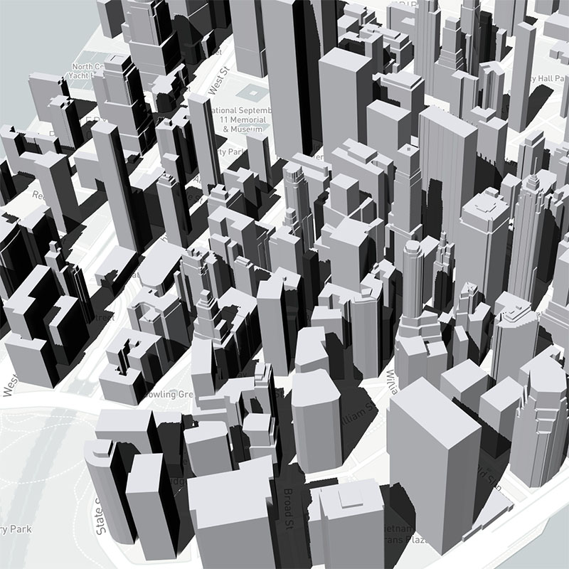 GeoJsonLayer with shadow |  HexagonLayer with shadow |
HeatmapLayer
The @deck.gl/aggregation-layers module now offers HeatmapLayer as an experimental layer. It performs density distribution on the GPU to provide fast dynamic heatmaps. The layer currently only supports WebGL2-enabled browsers. A fallback solution for WebGL1 will be added later.
Shadows in LightingEffect
As an experimental feature, the LightingEffect can now render shadows from up to two directional light sources. To enable shadows, set _shadow: true when constructing a
DirectionalLight or SunLight.
New Ways to Supply and Update Layer Data
Streaming Data Support
Layers now have built-in streaming support. The data prop now accepts an async iterable object. As new batches of data are resolved, the layer is updated incrementally. This eliminates the need to manually merge chunks of data or manage multiple layer instances.
See details in the data prop documentation and the updated performance optimization examples.
Partial Data Update
By default, when the data prop value of a layer changes shallowly, all of its attributes are recalculated and re-uploaded to the GPU. You may now compare the old and new data arrays and only update the range of elements that have actually changed. This can lead to significant performance improvement if a few rows in a large data table need to change frequently. See the _dataDiff prop documentation.
Using External Buffers
It is now easier to build attributes as typed arrays outside of a layer, e.g. in a web worker or on the server. See the "Supplying attributes directly" section in performance optimization.
Other Layer Features and Optimizations
- BitmapLayer's
imageprop now accepts aHTMLVideoElement. - TextLayer now supports line breaks in the text string. A new prop
lineHeightis added. - Layer matching performance is improved. This affects applications with a large number of layers.
- HeatmapLayer now supports WebGL1.
deck.gl v7.1
Release Date: 2019
Post-processing Effects
A new PostProcessEffect class, working with @luma.gl/effects module, offers screen-space post-processing effects such as blur, noise, halftone, ink, etc.
 noise effect |  colorHalftone effect |
 tiltShift effect | 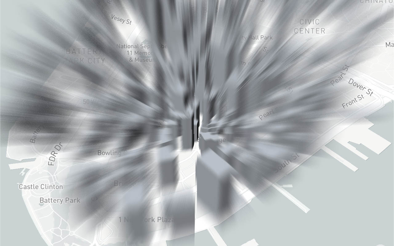 zoomBlur effect |
Layer Enhancements
GridLayer
GridLayer is enhanced to support GPU Aggregation. By default GPU Aggregation is disabled, and can be enabled using gpuAggregation prop. For more details check GridLayer. Two new layers GPUGridLayer and CPUGridLayer are also offered, which perform aggregation on CPU and GPU respectively.
The following table compares the performance between CPU and GPU aggregations using random data points:
| #points | CPU #iternations/sec | GPU #iterations/sec | Notes |
|---|---|---|---|
| 25K | 535 | 359 | GPU is 33% slower |
| 100K | 119 | 437 | GPU is 267% faster |
| 1M | 12.7 | 158 | GPU is 1144% faster |
Numbers are collected on a 2018 15-inch Macbook Pro (CPU: 2.6 GHz Intel Core i7 and GPU: Radeon Pro 560X 4 GB)
ColumnLayer & H3HexagonLayer
- Now support drawing outline. In 3D mode (extruded), set
wireframe: true. In 2D mode, enable stroke by settingstroked: truewithgetLineWidth,getLineColoramong other stroke options. - Improved the performance of
H3HexagonLayer.
PathLayer
- Added
billboardprop for screen space extrusion when rendering 3D paths - Improved precision of joint calculation
TripsLayer
- Now support 3D paths by adding a
getTimestampsaccessor. See layer documentation for details.
ScenegraphLayer
- Added
getSceneandgetAnimatorto allow more flexibility when loading models. - Experimental
_lightingproperty for PBR lighting. - Experimental
_imageBasedLightingEnvironmentproperty for image-based lighting.
64-bit Precision in Info-vis
OrthographicView and OrbitView now also support 64-bit projection, with no extra code changes required. This greatly improves the visual quality when rendering very large and/or dense graphs.
Use react-map-gl Components with DeckGL
For React users, it is now easy to use react-map-gl components with DeckGL, including DOM-based marker, popup, navigation control and fullscreen control. This can be done by supplying the ContextProvider prop on DeckGL:
/// Example using react-map-gl controls with deck.gl
import {DeckGL} from '@deck.gl/react';
import {_MapContext as MapContext, NavigationControl} from 'react-map-gl';

<DeckGL ... ContextProvider={MapContext.Provider}>
  <div style={{margin: 10, position: 'absolute', zIndex: 1}}>
    <NavigationControl />
  </div>
</DeckGL>
Performance Metrics
- Added a
metricsproperty toDeckinstances that tracks performance statistics like fps, CPU/GPU render time and memory usage. See Deck class documentation for details.
deck.gl v7.0
Release Date: April 19, 2019
New Layer Catalog
 BitmapLayer |  ColumnLayer |  TileLayer |
 S2Layer |  H3HexagonLayer |  H3ClusterLayer |
 TripsLayer |  ScenegraphLayer |  GreatCircleLayer |
As the number of deck.gl layers grow, we are splitting existing and new layers into multiple submodules for better dependency management. These new layer modules are:
@deck.gl/layers- Primitive layers that are the building blocks of all visualizations@deck.gl/aggregation-layers- Advanced layers that aggregate data into alternative representations, e.g. heatmap, contour, hex bins, etc.- ContourLayer
- GPUGridLayer
- GridLayer
- HexagonLayer
- ScreenGridLayer
@deck.gl/geo-layers- Additional layers that handle geospatial use cases and GIS formats.- GreatCircleLayer New
- H3ClusterLayer New
- H3HexagonLayer New
- S2Layer New
- TileLayer New
- TripsLayer New
@deck.gl/mesh-layers- Additional layers that render 3D meshes and scene graphs.- SimpleMeshLayer New
- ScenegraphLayer New
glTF Support and Loaders.gl

The new ScenegraphLayer and SimpleMeshLayer support loading 3D models and scenegraphs in the popular glTF™ asset format. glTF is a royalty-free specification for the efficient transmission and loading of 3D assets, with a rich ecosystem of tools and extensions. All variants of glTF 2.0 are supported, including binary .glb files as well as JSON .gltf files with binary assets in base64 encoding or in separate files.
We are releasing loaders.gl as a major new companion framework to deck.gl and luma.gl. Loaders.gl provides a suite of 3D file format loaders. See What's New in luma.gl v7.0 for more details.
New Effects System
 Ambient Light |  Point Light |
 Directional Light |  Camera Light |
A new effects system is written from the ground up for v7.0. This opens the possibilities for many exciting visual effect features down the road. As a start, we're introducing LightingEffect - an easier, more comprehensive way to control the lighting for your layers. See Using Lighting for details.
Layer API
- Binary data support: In v7.0 we are making binary data a first-class citizen of deck.gl. Whereas the
dataprop of layers only accepted JavaScript arrays in the past, you may now provide a non-iterable object todata. See example. - Size units: In the past, some deck.gl layers use pixel sizes (e.g.
IconLayer,TextLayer,LineLayerandArcLayer) and some layers use meter sizes (e.g.ScatterplotLayer,PathLayer). In v7.0 we are introducing new propssizeUnitsandwidthUnitsthat allow users to tweak these behaviors.*MinPixelsand*MaxPixelsprops are also added for layers that previously only support pixel sizes. - Billboard: Prior this v7.0,
IconLayerandTextLayerare rendered as billboards (i.e. always facing the camera). A propbillboardis added to these layers so that you can place icons and texts relative to the world.
Google Maps Integration
Starting v7.0, deck.gl has experimental support for Google Maps with the @deck.gl/google-maps module. It allows you to construct a Deck instance as a custom Google Maps OverlayView. See module documentation page for a full list of supported features.

GoogleMapsOverlay
Improved Test Utilities
The @deck.gl/test-utils module is revamped with two new exports:
generateLayerTests- automatically create test cases for use withtestLayerto test layer conformance.SnapshotTestRunner- automated integration test for WebGL. Renders deck.gl layers, takes screenshot and compare with golden images in headless Chromium.
Read more in Developer Guide: Testing.
deck.gl v6.4
Release Date: Jan 29, 2019
 SDF font in TextLayer |  Stroke and fill in ScatterplotLayer |  Isoband in ContourLayer |
Layer API Improvements
ScatterplotLayernow supports drawing both stroke and fill, and outline width can be controlled per-instance.ContourLayernow supports isoband - filling between two thresholds.ScreenGridLayernow supports aggregating by min/max/mean.TextLayeradds new props that allow better control of the font rendering quality, including font weight and raster size. The layer can also optionally generate a font atlas with Signed Distance Fields, which yields a much crisper look when rendering large font sizes.IconLayersupports dynamically packed icon atlas. Users can now load programmatically generated image urls as icons, for example Facebook profile images.PathLayer'sgetPathandPolygonLayer'sgetPolygonprops now support flattened coordinates instead of nested arrays, making it easier for these layers to use binary data.
See each layer's documentation for full API changes.
Composite Layer Customization (experimental)
It is now possible to fine-tune sublayer appearances by passing a new experimental prop _subLayerProps to a composite layer. For example, in a GeoJsonLayer, one may wish to make only the point features interactive, or replace the circles with icons.
This offers a light alternative to overriding composite layer behaviors without creating a custom class. See CompositeLayer for details.
deck.gl v6.3
Release Date: Nov 19, 2018
Prop Types System
Layers can now supply rich definitions to their default props. This enables prop validation in debug mode and aggressively blocks unnecessary layer update to boost rendering performance. Complex composite layers such as the GeoJsonLayer can be up to 2x faster in certain React applications. See upgrade guide if you are an author of custom layers.
New Interaction Callbacks
onDragStart, onDrag and onDragEnd callback props are added to Deck and base Layer class.
GPUAggregator Improvements
The experimental GPUAggregator class now supports Min/Max/Mean in addition to Sum. Also added the ability to specify multiple weights with custom aggregation operation.
deck.gl v6.2
Release Date: Oct 15, 2018
 32-bit High-Precision Projection |  Mixing Mapbox and deck.gl Layers |
Mapbox Custom Layer API
A new experimental module @deck.gl/mapbox makes deck.gl work with the custom layers API in the latest Mapbox release. Using this feature, mapbox and deck.gl layers can be freely "interleaved", enabling a number of layer mixing effects, such as drawing behind map labels, z-occlusion between deck.gl 3D objects and Mapbox buildings, etc. For usage and limitations, see module documentation.
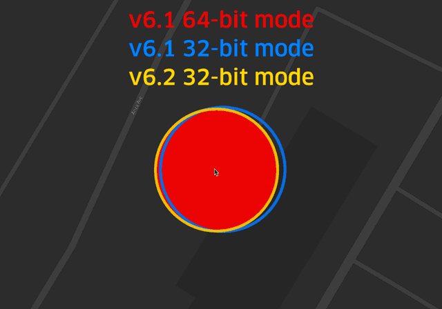
32-bit High-Precision Projection
First introduced in v6.1 as COORDINATE_SYSTEM.LNGLAT_EXPERIMENTAL, the new projection system offers high-precision results similar to that of the old fp64 mode without the compatibility issues or performance hit of running the much heavier 64-bit shader. Starting v6.2, this coordinate system becomes the default for all layers. See upgrade guide if you still need the old fp64 mode.
CPU/GPU Parity in Projection
The layer.project() method now supports all coordinate systems including METER_OFFSETS, LNGLAT_OFFSETS and IDENTITY.
deck.gl v6.1
Release date: Sep 7, 2018
 JSON API |  Enhanced Multi-View API |  ContourLayer |
High-Precision Geospatial Projection (Experimental)
The projection algorithm used for geospatial coordinates (layers with coordinateSystem: COORDINATE_SYSTEM.LNGLAT) has supplemented with a "hybrid" projection/offset based implementation (COORDINATE_SYSTEM.LNGLAT_EXPERIMENTAL) that rivals 64-bit precision at 32-bit speeds. This mode is expected to make the use of fp64 precision unnecessary for most applications, which in turn should increase application performance and avoid issues on untested graphics drivers.
Dynamic Meridian
LNGLAT projection modes can automatically wrap coordinates over the 180th meridian for the best placement in the current viewport. Set the wrapLongitude prop in a layer to true to enable this behavior. This mode will be helpful when visualizing data close to the ante-meridian (e.g. New Zealand, Australia etc).
JSON API (Experimental)
A new experimental module @deck.gl/json provides a set of classes that allows deck.gl layers and views to be specified using JSON-formatted text files. To facilitate experimentation, a JSON layer browser is available on http://deck.gl/playground.
Enhanced Multiview Support
deck.gl's multiview support has been significantly enhanced. New View properties give applications more control over rendering, making it possible to implement e.g. overlapping views, partially synchronized views (share some but not all view state props), views with different background colors etc.
ContourLayer
deck.gl's layer catalog is extended by adding new ContourLayer, this layer can be used to render contours, also called iso-lines for given set of threshold values. ContourLayer supports both WebMercator projection (geospatial applications) and Orthographic projection (infovis applications).
IconLayer
When the mask of the icon is false, the opacity of the icon can be controlled by getColor while still keeping the pixel color from image. When mask is true, user defined color is applied.
GPU Aggregation Enhancements (Experimental)
Several under the hood changes in GPU Aggregation flow to support multiple layer coordinate systems (LNGLAT and IDENTITY).
deck.gl v6.0
Release date: July 18, 2018
GeoJson Transition | ViewState flyTo Transitions |  GPU Accelerated ScreenGrid Layer |
Attribute Transitions (WebGL2-compatible browsers only)
Attribute transitions enable applications to simultaneously animate changes in positions, colors and other attributes of all objects in a layer. GPU acceleration to All core deck.gl layers now support attribute transitions, including HexagonLayer, GridLayer and GeoJsonLayer. GPU Accelerations allow millions of objects to be animated. Transition settings also support enter callback to customize instance entrance behavior. See documentation of the transitions prop.
View State Transitions
View State Transitions (aka Viewport Transitions) are now officially supported. Transitions are provided through the DeckGL.viewState prop. For more details check ViewState Transitions documentation.
ScreenGridLayer: GPU accelerated aggregation
ScreenGridLayer is updated to support aggregation on GPU. GPU aggregation can be 10x faster and is capable of aggregating large data sets (millions of points). Two new props gpuAggregation for selecting CPU or GPU aggregation and cellMarginPixels to control cell margin size have been added. Finally, picking information now contains aggregated details.
Controllers: Simplified Usage
deck.gl can now infer appropriate Controller types from the types of your View. For example, when using the default geospatial view (MapView), a MapController can now be requested simply by setting the view's controller props to true. You may also pass an object with additional controller options to this prop, for example controller={{doubleClickZoom: false}}. See documentation of View.
Pixel Sizes aligned with HTML/CSS
deck.gl pixel sizes (e.g. in LineLayer, IconLayer and TextLayer) now match their HTML/SVG counterparts.
WebGL parameters can now be set declaratively
It is now possible to set global WebGL parameters (controlling how the GPU renders) by supplying a Deck.parameters property object. This gives applications a simple declarative way to control things like blend modes and depth testing, without having to define an onWebGLInitialized() callback. Note that parameters can still be supplied to individual layers, overriding any global parameters for that layer only.
React API Enhancements
The DeckGL React component now provides a more powerful API to create sophisticated visualizations, highlights including:
DeckGLcan be used as a "stateful" component providing automatic interactivity- You can now specify deck.gl views (in addition to layers) directly using JSX
- Adds "render callbacks" for dynamically rendering React children based on deck.gl view states, providing more control over synchronization of positions and sizes between deck.gl's WebGL view layouts and React's DOM components.
See Use with React for more details.
deck.gl v5.3
Release date: June 01, 2018
 Orthographic Mode |
Automatic Interactivity
A new Deck.initialViewState property allows the application to enable map or view interactivity simply by supplying an initial view state, e.g. {longitude, latitude, zoom}. deck.gl will automatically initialize a Controller class and listen to view state changes, without the application having to implement callbacks to track the view state.
Automatic Data Loading
The Layer.data prop now accepts URLs (i.e. strings). deck.gl will automatically start loading such URLs, parse them as JSON and once loaded, use the resulting data to render the layer. This can e.g. remove the need for applications to set up callbacks to handle load completion.
Deep Picking
deck.gl can now pick occluded objects using the new Deck.pickMultipleObjects method, which returns a list of all objects under the mouse, instead of just the top-most object.
Switch between Perspective and Orthographic mode
The View classes can now build an orthographic projection matrix from the same "field of view" parameter it uses to create perspective mode (rather than requiring a separate set of parameters). This makes switching between perspective and orthographic projection modes easier then ever (simply set the new View.orthographic prop to true to activate orthographic projection).
Per-instance stroke width in LineLayer and ArcLayer
LineLayer and ArcLayer added a new accessor getStrokeWidth to replace the old strokeWidth prop. When specified with a function, you can control the width of each arc/line segment dynamically.
Constant Accessors
Many layer accessor props now accept constant values. For example, when constructing a ScatterplotLayer, what used to be getColor: d => [255, 200, 0] can now be written as getColor: [255, 200, 0]. This is not only a convenience: constant values of accessors don't use GPU memory and can be updated very quickly and thus do not require an updateTrigger. Consult the documentation for each layer to see which accessors are supported.
@deck.gl/layers submodule
Core layers are broken out from @deck.gl/core to a new submodule @deck.gl/layers. Users of deck.gl are not affected by this change.
deck.gl v5.2
Release date: April 24, 2018
 New TextLayer |  ScreenGridLayer Color Scale |  Automated Render Tests |
Use deck.gl without React
deck.gl can now be used in non-React applications. A new top-level JavaScript class Deck is provided as an alternative to the traditional top-level DeckGL React component, and the core deck.gl npm module no longer has any React dependencies. This allows deck.gl to be used in any JavaScript application or framework.
The new non-React API is officially supported, however since it is not yet extensively battle-tested in applications there may be some rough corners, so to help developers set expectations we are labeling this as a "pre release" intended for early adopters.
Scripting Support
deck.gl now publishes a bundle that can be imported using a simple <script> statement in HTML to give access to the deck.gl API. This makes deck.gl easy to use in e.g. "codepens" and for casual programming and visualizations.
See our scripting blog post.
Multiple Modules
deck.gl is now published as multiple npm modules allowing applications to choose which features to import. The basic modules are:
@deck.gl/core- the core deck.gl API (JavaScript classes, including theDecktop-level class).@deck.gl/react- React bindings for deck.gl (i.e. the top-levelDeckGLReact class).deck.gl- The classic module is still supported for backwards compatibility with React applications.
Multi-Viewport Support
deck.gl allows you to divide your screen into multiple viewports and render layers from different perspectives. It is e.g. possible to render a top-down map view next to a first person view and allow your users to "walk around" in the city onto which your data is overlaid.
The Deck.views property accepts instances of View classes, such as MapView and FirstPersonView:
<DeckGL
  views=[
    new MapView({id: 'map', width: '50%'}),
    new FirstPersonView({x: '50%', width: '50%'})
  ]
/>
MapController
It is now possible to specify a MapController as a controller for the Deck or DeckGL classes, instead of relying on e.g. react-map-gl or experimental classes to drive event handling.
Automatic Resize Handling
It is no longer necessary for deck.gl applications to track screen size and manage the exact width and height of the Deck or DeckGL components. width and height can now be specified using CSS descriptors (e.g. width = 100%):
<DeckGL width='100%' height='100%'/>
Layers
TextLayer (New)
A TextLayer has been added to the core layer catalog for rendering labels with WebGL.
ScreenGridLayer
Color Scale Support (Experimental) - New experimental props colorRange and colorDomain are added to ScreenGridLayer. These props provide more fine tune control over how grid cells are colored, and brings the ScreenGridLayer into parity with other aggregation layers (i.e. HexagonLayer and GridLayer).
Experimental Layers
A number of experimental deck.gl layers are published in a new module @deck.gl/experimental-layers. Be aware that use of these layers come with caveats and are mainly intended for early adopters. Please refer to roadmap for more information.
Test Utilities
deck.gl now provides a suite of test utilities that make it easy to test both layers and applications. The utilities support visual regression testing against "golden" images, as well as utilities for traditional unit testing of layers. The utilities come pre-integrated with tools that help automate the running of browser based render tests from the console. To start using the utilities, install the new (@deck.gl/test-utils) module.
Dist Size Reduction
Work on bundle size reduction continues. In this release, the focus has been on leveraging the tree-shaking abilities of the Babel 7 and Webpack 4 combination. In addition, new article about Application Bundling and Tree Shaking has been added to the docs.
Shader Modules
project32 (New)
Unified 32/64-bit projection - A new common API for projection is implemented in both the project64 shader module and a new project32 shader module allowing the same vertex shader can be used for both 32-bit and 64-bit projection. This simplifies adding fp64 support to layers and reduces bundle size. See docs for more details.
deck.gl v5.1
Release date: Feb 16, 2018
Layer Transitions |  JSX Layers |
Layer Improvements
Layer Transitions
Many layers now support smooth visual transitions of e.g. positions and colors of layer elements, animating the update of the layers element to match a new data set. The animations are done on the GPU and can thus support very large number of elements. Use the new transitions prop on the Layer class to specify things like transition duration, easing function and callbacks.
Transitions are only supported on WebGL2-capable browsers such as Chrome and Firefox. The
transitionsprop will simply be ignored on WebGL1 browsers.
React Improvements
Use JSX to render deck.gl Layers
It is now possible to use JSX syntax to create (or "render") deck.gl layers. Many React users feel that this results in a more natural coding style.
  <DeckGL {...viewport}>
    <LineLayer data={data} />
  <DeckGL />
There are limitations (deck.gl layers are not React components), for more information see Using deck.gl with React.
deck.gl v5
Release date: Dec 21, 2017
 GPU-based Highlighting |  Dashes in GeoJson |  React 16 Support |
All new additions to the official deck.gl 5.0 API are listed here. Note that in addition to the official new features in this release, deck.gl 5.0 also contains a number of significant under the hoods changes to prepare for new features and optimizations. Some of these are available as experimental APIs, see below.
As always, for information on deprecations and how to update your code in response to any API changes, please read the deck.gl upgrade Guide.
DeckGL Component
DeckGL: Control over DevicePixelRatio
The new useDevicePixels prop on the DeckGL React component can be used to disable usage of full resolution on retina/HD displays. Disabling deck.gl's default behavior of always rendering at maximum device resolution can reduce the render buffer size with a factor of 4x on retina devices and lead to significant performance improvements on typical fragment shader bound rendering. This option can be especially interesting on "retina" type mobile phone displays where pixels are so small that the visual quality loss may be largely imperceptible.
DeckGL: Layer Filtering
A new DeckGL prop layerFilter gives the application an opportunity to filter out layers from the layer list during rendering and/or picking. Filtering can be done per layer or per viewport (experimental) or both. This enables techniques like adding helper layers that work as masks during picking but do not show up during rendering, or rendering different additional information in different viewports (experimental).
DeckGL: Allow overriding canvas component style
Users can now override the canvas size, position and offset via the style prop passed to the DeckGL component.
Layer Improvements
Layer: Automatic Highlighting of Hovered Elements
Three new Layer props (autoHighlight, highlightColor and highlightedObjectIndex) have been added to enable simple and efficient highlighting of a single object in a layer. Highlighting is either automatic on hover, or programmatically controlled through specifying the index of the selected object. The actual highlighting is done on the GPU and this feature is thus very performant, in particular as it lets applications avoid cumbersome techniques like modifying data or using a secondary layer for highlighting.
See our blog post
CompositeLayer: Property Forwarding Support
A new method CompositeLayer.getSubLayerProps() simplifies forwarding base layer props to sub layers, removing code clutter and reducing the risk of forgetting to forward an important base layer property.
PathLayer & GeoJsonLayer: Dashed Line Support
Added new props (getDashArray and dashJustified) enabling you render paths as dashed lines. Naturally these props are also accessible in composite layers built on top of the PathLayer, such as the GeoJsonLayer.
PolygonLayer & GeoJsonLayer: Elevation Scale
Added new prop elevationScale to enable fast scaling elevation of all extruded polygons.
HexagonLayer / GridLayer: Elevation by Value Support
Add getElevationValue to HexagonLayer and GridLayer to enable elevation aggregation by value. This allow both color and elevation to be calculated based on customized aggregation function.
Seer Improvements
The Seer Chrome Debug Extension now remembers its "on/off" setting across application reloads. This is significant because it means that the Seer extension can be left installed even in heavy deck.gl applications with lots of layers, and turned on only during debugging, without any performance impact during normal usage.
Shader Modules
Note: This change is mainly relevant to developers who write custom deck.gl layers.
- Shader module documentation is much improved, both in deck.gl and luma.gl. In the deck.gl docs, shader modules are listed in the "API Reference" section, after the JavaScript classes.
- The
projectmodule provides a new functionproject_pixel_to_clipspacefor screen space calculations that takes variables likeuseDevicePixelsand "focal distance" into account, making pixel space calculation simpler and less prone to fail when parameters change. - The core deck.gl shader modules (
projectetc) now conform to the luma.gl shadertools conventions for naming uniforms and functions, making this module easier to describe and use. In spite of these changes, backwards compatible uniforms are provided to ensure that existing layers do not break.
React Integration
React 16 Support
deck.gl v5 now supports React 16 and the package.json dependencies of all React-based examples have updated to React 16.
Experimental Features
As usual, deck.gl 5.0 contains a number of experimental features, e.g. "multi viewport", "first person viewport" and "viewport transitions". These features are still being finalized and the APIs have not been frozen, but can still be accessed by early adopters. See the roadmap article for more information on these.
deck.gl v4.1
Release date: July 27th, 2017
 WebGL 2 |  Seer Extension |
WebGL2 Support (provided by luma.gl v4)
deck.gl v4.1 is based on luma.gl v4, a major release that adds full WebGL2 support as well as powerful features like WebGL state management and an improve GLSL shader module system. On all browsers that supports WebGL2 (e.g. recent Chrome and Firefox browsers), deck.gl will obtain WebGL2 context and utilize WebGL2 functionalities. To know more about WebGL2, please check here.
Query Methods
Two new functions - DeckGL.queryObject and DeckGL.queryVisibleObjects allow developers to directly query the picking results, in addition to handling picking via built-in click and hover callbacks. This allows applications to build more advanced event handling and makes deck.gl easier to integrate with existing applications that have already implemented their own event handling.
In addition, the queryObject offers a much requested radius parameter, allowing the application to specify how close an object needs to be to the specified coordinate to be considered a match (in deck.gl v4.0, picking will only trigger if an object is actually visible on the queried pixel, making it hard for users to select small features and thin lines).
Shader Assembly
For developers that write their own custom layers, the shadertools shader assembly system is now in place to replace the existing assembleShaders function in deck.gl. The new shader assembler system supports organizing shader code into modules and is integrated with luma.gl's Model so users no longer need to call assembleShaders before creating the Model for the layer.
Per-Layer Control of WebGL Parameters
The base Layer class (which is inherited by all layers) supports a new property parameters that allows applications to specify the state of WebGL parameters such as blending mode, depth testing etc. This provides applications with significant control over the detailed rendering of layers. Note that the new parameters prop directly leverages the luma.gl v4 setParameters API, which allows all WebGL parameters to be specified as keys in a single parameter object.
Layer Attribute Control
Pre-calculated "Vertex Attributes" can now be passed as props, meaning that developers that are willing to learn how a deck.gl layer's vertex attributes are structured can pass in typed arrays as props to the layer and have these directly passed to the GPU. This prevents the layer's internal AttributeManager from generating the attributes from your data, allowing you to optimize by e.g. directly passing in binary data from calculations or a binary file load without having deck.gl do any transformation on your data.
CompositeLayer
Composite layers, which were introduced in v4.0, have received some polish and performance improvements. In subclassed CompositeLayers, the renderLayers function can now return a nested array that could contain null values, and deck.gl will automatically flatten, filter and render all layers in the array. This is a small convenience that can make your renderLayers methods in complex composite layers a little more readable.
   renderLayers() {
      return [
         setting1 && new ScatterplotLayer(...),
         setting2 && new LineLayer(...),
         this._renderAdditionalLayerList()
      ];
   }
Also, as a performance improvements, deck.gl now avoids "rerendering" sublayers of CompositeLayer whose props haven't changed.
New Examples
Several new examples have been added to illustrate the wide applicability of deck.gl. To name a few:
- Wind visualization in US. This example is featured on OpenVIS 2017 by @philogb. This example shows how new features in WebGL2 can be used to accelerate compute intensive tasks through GPU computing right in the browsers
- Tagmap - This example by @rivulet-zhang shows some novel approching in placing and rendering text symbols in deck.gl
- Point cloud example - The point cloud example shows how deck.gl could be used to render large amount of 3D point cloud data without any basemap context.
- Node-link Graph - This is another example showing how deck.gl could be extended to the info-vis domain.
Touch Support
deck.gl's default event handling now includes support for multitouch gestures to zoom and rotate the view. In addition, a new EventManager class solidifies deck.gl's support for event handling.
Seer Integration
deck.gl is now integrated with the new Seer Chrome extension. Simply installing Seer and rerunning your application opens up a new tab in the Chrome developer tools, providing you with the ability to see all your deck.gl layers, inspect (and edit) their properties and attributes and check per layer timings, such as the latest GPU draw calls or attribute updates.
And note that since luma.gl v4 also has a Seer integration, it is possible to follow links from deck.gl layer to luma.gl models inside Seer, enabling you to further drill down and understand what data is ultimately being generated and processed by the GPU.
deck.gl v4.0
Release date: March 31, 2017
Highlights
- New Geospatial Layers GeoJsonLayer, PathLayer, PolygonLayer, IconLayer, GridCellLayer, HexagonCellLayer, PointCloudLayer.
- New Aggregating Layers GridLayer and HexagonLayer now join the ScreenGridLayer in a growing family of layers that automatically "bin" your point data, in this case into grid cells or hexagons.
- New Examples deck.gl now provides multiple stand-alone examples, with minimal configuration files (
package.json,webpack.config.jsetc) intended to make it easy to just copy an example folder and get an app up and running in minutes. - Unified 64-bit Layers - 64-bit Layers are now unified with 32-bit layers, controlled via a new
fp64prop. - Library Size Reduction - A number of npm package dependencies have been trimmed from deck.gl, and the distribution has initial support for "tree-shaking" bundlers like webpack2 and rollup.
- Performance A number of improvements across the core library and layers improves rendering and picking performance.
- Model Matrix Support - Model matrix support for the
METER_OFFSETprojection mode enables arbitrary coordinate transforms (translations, rotations, scaling etc) to be applied on individual layer enabling scene graph like layer composition and animation. - Documentation Improved and reorganized in response to user feedback.
- Experimental Features Experimental support for non-Mercator projections and rendering effects (e.g. Reflections)
New Layers
GeoJsonLayer
A layer that parses and renders GeoJson. Supports all GeoJson primitives (polygons, lines and points).
The GeoJsonLayer is an example of a composite layer that instantiates other layers (in this case PathLayer, PolygonLayer and ScatterplotLayer) to do the actual rendering. This layer replaces the now deprecated family of ChoroplethLayers.
PathLayer
Takes a sequence of coordinates and renders them as a thick line with mitered or rounded end caps.
PolygonLayer
Each object in data is expected to provide a "closed" sequence of coordinates and renders them as a polygon, optionally extruded or in wireframe mode. Supports polygons with holes.
IconLayer
Allows the user to provide a texture atlas and a JSON configuration specifying where icons are located in the atlas.
GridLayer
A layer that draws rectangular, optionally elevated cells. A typical grid based heatmap layer. Differs from the ScreenGridLayer in that the cells are in world coordinates and pre aggregated.
HexagonLayer
A layer that draws hexagonal, optionally elevated cells.
Point Cloud Layer
Draws a LiDAR point cloud. Supports point position/normal/color.
Improvements to all Layers
Support for Per-Layer Model Matrix
Each layer now supports a modelMatrix property that can be used to specify a local coordinate system for the data in that layer:
-
Model matrices can dramatically simplify working with data in different coordinate systems, as the data does not need to be pre-transformed into a common coordinate system.
-
Model matrices also enable interesting layer animation and composition possibilities as individual layers can be scaled, rotated, translated etc with very low computational cost (i.e. without modifying the data).
UpdateTriggers now accept Accessor Names
updateTriggers now accept Accessor Names.
The updateTriggers mechanism in deck.gl v3 required the user to know the name of the vertex attribute controlled by an accessor. It is now possible to supply names of accessors.
More intuitive mouse events
onHoveris now only fired on entering/exiting an object instead of on mouse move.onClickis now only fired on the picked layer instead of all pickable layers.
New Features for Layer Subclassing
Overridable Shaders
All layers now have a getShaders method that can be overridden by subclasses, enables reuse of all layer code while just replacing one or both shaders, often dramatically reducing the amount of code needed to add a small feature or change to en existing layers.
New Features for Layer Writers
defaultProps
Layers are now encouraged to define a defaultProps static member listing their props and default values, rather than programmatically declaring the props in constructor parameters etc. Using defaultProps means that many layer classes no longer need a constructor.
AttributeManager now accepts new accessor field
Can be a string or a an array of strings. Will be used to match updateTriggers accessor names with instance attributes.
getPickingInfo()
This method replaces the old pick() method and is expected to return an info object. Layers can block the execution of callback functions by returning null.
Performance
A number of performance improvements and fixes have been gradually introduced since deck.gl v3.0 was launched. While many are not new in v4.0, cumulatively they enable noticeably better framerates and a lighter footprint when big data sets are loaded, compared to the initial v3.0.0 version.
The AttributeManager class now supports default logging of timings for attribute updates. This logging can be activated by simply setting deck.log.priority=2 in the console (levels 1 and 2 provide different amounts of detail). This can be very helpful in verifying that your application is not triggering unnecessary attribute updates.
In addition, the new function AttributeManager.setDefaultLogFunctions allows the app to install its own custom logging functions to take even more control over logging of attribute updates.
Library Improvements
JavaScript build tooling continues to evolve and efforts have been made to ensure deck.gl supports several popular new tooling setups:
- Dependency Reduction The number of npm dependencies (both in
deck.gl,luma.glandreact-map-gl) have been reduced considerably, meaning that installing deck.gl and related modules will bring in less additional JavaScript code into your app, and your app will build and run faster. - Tree-shaking support: deck.gl and related libraries now publish a "module" entry point in package.json which points to a parallel distribution (
deck.gl/dist-es6) that preserves theimportandexportstatements. This should allow tree shaking bundlers such as webpack 2 and rollup to further reduce bundle size. - Pure ES6 source code: With few exceptions (e.g some JSX usage in examples), the source code of deck.gl and related modules are now all restricted to conformant ES6 (i.e. no ES2016 or ES2017, flow or similar syntax is used). This means that the source code can run directly (ie. without transpilation) in Node.js and modern browsers. You could potentially import code directly from
deck.gl/srcto experiment with this. - Buble support in examples. Buble is a nice alternative to babel if you have a simple app and don't need all the power of babel. Many of the examples now use buble for faster and smaller builds.
Examples
Code examples have been improved in several ways:
- Multiple Examples deck.gl now provides multiple different examples in an
examplesfolder, showing various interesting uses of deck.gl. - Stand Alone Examples Examples are now stand alone, each with its own minimal
package.jsonand configuration files, enabling them to be easily copied and modified. - Hello World Examples Minimal examples for building with webpack 2 and browserify (previously called "exhibits") are still provided, and have been further simplified.
- Layer Browser The main
layer-browserexample has been expanded into a full "layer and property browser" allowing for easy testing of layers.
Deprecations
The various Choropleth layers have been deprecated since deck.gl has new and better layers (GeoJsonLayer, PathLayer, PolygonLayer) that fill the same roles. The choropleth layers are still available but will not be maintained beyond critical bug fixes and will likely be removed in the next major version of deck.gl.
A careful API audit has also been done to align property names between old and new layers. While this will makes the layers more consistent and the combined API easier to learn and work with, it does mean that some properties have been renamed, with the old name being deprecated, and in some very few cases, default values have changed.
For more information on deprecations and how to update your code in response to these changes, please consult the deck.gl Upgrade Guide.
deck.gl v3.0
Release date: November, 2016
Highlights
- New website
- Comprehensive documentation
- All Core Layers updated (API, features, performance)
- 64-bit Layers (High Precision)
- METERS projection mode (High Precision)
- Multi-Primitive Layer Support
- Composite Layer Support
React Integration
DeckGL(DeckGLOverlayin v2) component now requires a separate import (import DeckGL from 'deck.gl/react'). This allows the core deck.gl library to be imported by non-React applications without pulling in React.- Adds
onLayerClickandonLayerHoverprops to theDeckGLReact component. - The
DeckGLcomponent now cancels animation loop on unmount, important when repeatedly creating/destroying deck.gl components. - The
DeckGLcomponent no longer manages WebGL blending modes, as this is better done directly by layers.
Layers
- All layers now support accessors, removing the need for applications to transform data before passing it to deck.gl.
- Layer props and accessors now always expect arrays (e.g. colors are expected as
[r,g,b,a]instead of{r,g,b,a}etc). - line widths now takes device pixel ratio into account for more consistent look between displays
- METERS projection mode allows specifying positions in meter offsets in addition to longitude/latitude.
- Layers now receive viewport information from the
DeckGLcomponent. This implies that apps no longer need to pass thewidth,height,longitude,latitude,zoom,pitch,bearingandbearingprops to each layer. These properties only need to be passed to theDeckGLreact component.
Base Layer
deepCompareprop replaced with more flexibledataComparator
ArcLayer
- Specify separate start and end color for each arc.
- Renders smoother arcs, especially for bottom arc segments close to map
- Fixes flickering last segments
ScatterplotLayer
- Adds drawOutline option.
ScreenGridLayer
- New name for deck.gl v2 GridLayer
- Now have accessors (getPosition, getWeight)
- Custom color ramps (minColor, maxColor)
ChoroplethLayer
- Now renders MultiPolygons and Polygons with holes
HexagonLayer (REMOVED)
- The v2 HexagonLayer has not yet been ported to v3.
64bit layers
A set of new high precision layers that support extreme zoom levels
ArcLayer64 (NEW)
ChoroplethLayer64 (NEW)
ScatterplotLayer64 (NEW)
64 bit ExtrudedChoroplethLayer (NEW)
- Great for rendering 3D buildings on top of maps
- Includes a basic shading model
GeoJsonLayer (NEW, EXPERIMENTAL)
- Initial composite layer, only Polygons for now.
Sample Layers
Sample layers now available through import 'deck.gl/samples';
Changes affecting Custom Layers
Streamlined life cycle methods
- The Layer life cycle methods are now optimized for deck.gl's needs and no longer try to mimic React.
- Limited compatibility with deck.gl v2 is provided but it is strongly recommended to update layers to the new methods
Optimizations
Uint8Arrayencoding is now supported for color and picking color attributes, which provides significant GPU memory savings.
GLSL package manager and modules
- All layers now use
assembleShadersto inject GLSL packages and platform fixes - GLSL
projectpackage- GLSL
fp64emulated double precision floating point package - GLSL
fp32package - 32bit improved precision library- Adds high precision version of trigonometry functions and
tan - Especially for Intel GPUs
- Adds high precision version of trigonometry functions and
- GLSL
deck.gl v2
Release date: May 2016
Highlights
- 3D Perspective Mode
- Performance: Huge under the hood refactor of layer update logic
- Automatic attribute management (
AttributeManagerclass) - Linux fixes - deck.gl and luma.gl now work on Linux.
- Adopts luma.gl as default WebGL framework.
- Retina display support
- Support for disabling mercator project (experimental)
React Integration
- Ability to specify canvas ID and customize styles
Layers
- Added data deep comparison support
ScatterplotLayer
- Add per point radius support for the scatterplot-layer
- Added per point color support for the scatterplot-layer
- Fixed primitive distortion bug
LineLayer (NEW)
deck.gl v1
Original release date: December 2015
Initial open-source version of deck.gl, with five sample layers.